Loading...

Address: Brgy. Cuyambay, Tanay, Rizal
Sub-Category: Mountain
Area: 35 hectares (approximately)
Owner Jurisdiction: Local Government Unit Tanay
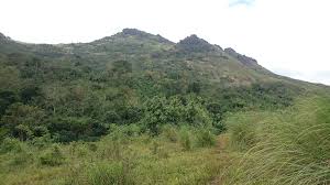
Description: Mount Paliparan, sometimes called Paliparan Summit, the highest point is elevated at approximately 680 MASL. It is distinguished as part of the ancestral domain of the Dumagat in Cuyambay – although a formal declaration and title are yet to be released by the National Commission on Indigenous People (NCIP). According to a local NCIP representative, an application has been filed in 2009. Mount Paliparan forms a ridge and has a connection to Nagpatong Rock. The mountain was once an early Dumagat settlement. It got its name from the early residents practice of holding kite-fights here – a pastime where crops and livestock are at stake.
Stories: Mount Paliparan also served as a hideout during Japanese colonization. It is laden with numerous caves and caverns where natives stay during the day to evade Japanese soldiers. Most of these caves remain unexplored since then. The foot of the mountain, which was all fields and plains, was where the Japanese set up camp and it was at night that the early Dumagat sneaked out to steal salt – a commodity the natives prized because of its food- preserving properties – from the sleeping invaders. The area also used to take aerial bombings head on, the attacks leaving many duds in Cuyambay. In fact, one is used as a batingting (bell) in the local elementary school.